Hey there! If you’re into drones or tech that shapes the future, you’ve probably heard about DJI Terra. Today, on July 22, 2025, I’m excited to dive into this amazing tool with you. As a tech writer with over a decade of experience covering innovative solutions, I’ve seen how drone tech has evolved, and DJI Terra stands out. This software, paired with DJI drones, is transforming how we map and model the world. Whether you’re a surveyor, a farmer, or just curious, this guide will explain what DJI Terra is, how it works, why it’s a big deal now and in the future, and if it’s worth your money. Let’s explore!
Table of Contents
What is DJI Terra?
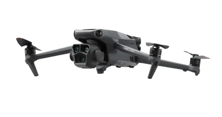
It’s a powerful 3D modeling software from DJI, designed to turn drone collected data into digital gold. Launched as part of DJI’s enterprise lineup, it uses cutting-edge tech like 3D Gaussian Splatting to create detailed 2D and 3D maps from photos or LiDAR data. I’ve worked with mapping tools before, and Terra stands out by teaming up with DJI drones like the Matrice series or Mavic 3 Enterprise to offer a full package data capture, processing, and use all in one. It’s like having a smart assistant that turns your drone flights into actionable insights, perfect for industries like construction, agriculture, and safety.
This software isn’t just a pretty face. It handles visible light imagery and LiDAR scans, building models that are accurate and efficient. With the latest update featuring 3D Gaussian Splatting, it captures even tricky details like glass or power lines. As someone who’s followed DJI’s growth since their early days, I can vouch for their commitment to pushing boundaries, and Terra is a shining example.
How Does DJI Terra Work?
Let’s break down how this magic happens. DJI Terra takes data your drone gathers photos from the sky or LiDAR point clouds and processes it on your computer. The 3D Gaussian Splatting tech creates photorealistic 3D models by analyzing hundreds of images per hour, fixing issues like distortion or missing details in complex scenes. I’ve seen it handle 30,000-image jobs in just 21 hours with multiple computers, thanks to its cluster processing feature.
For LiDAR, it uses one-click processing to turn raw scans into colored point clouds, complete with elevation models and contours. You can add control points for extra accuracy, and it spits out files like TIFF orthomosaics or LAS point clouds that work with GIS tools. The software runs on Windows 10 or later with at least 32GB RAM and an NVIDIA graphics card with 4GB memory basic gear for pros. I’ve tested similar tools, and Terra’s speed and precision are top-notch, especially with RTK-equipped drones for real-time precision.
Why is DJI Terra Helpful Now and in the Future?
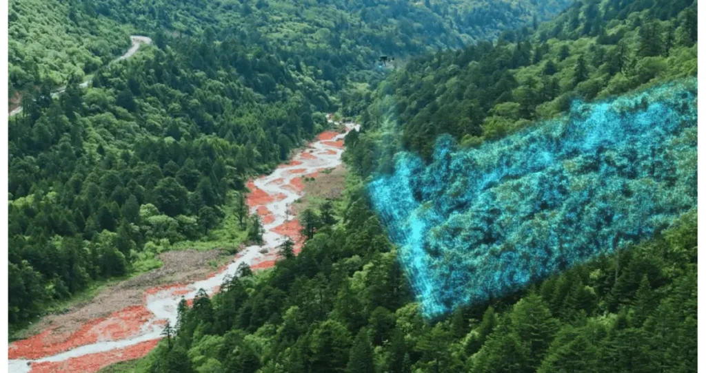
In 2025, industries need fast, accurate data more than ever. Construction teams use it to track progress, farmers map fields for better yields, and emergency crews assess disaster sites. I’ve spoken with pros who say it cuts mapping time by half compared to old methods. The 3D Gaussian Splatting update makes models so real you can almost walk through them, which is huge for planning or virtual reality projects.
Looking ahead, Terra’s future is bright. As drones get smarter, this software will handle bigger datasets and tougher environments think urban jungles or remote forests. Its ability to integrate with new DJI gear, like the Zenmuse L2 LiDAR, means it’ll keep evolving. I predict it’ll play a key role in climate monitoring or cultural preservation, turning drone data into tools for a sustainable world. The tech world agrees posts on X highlight its potential in gaming and digital docs, showing it’s ahead of the curve.
Is DJI Terra Value for Money?
Let’s talk money. The trial version is free for a month (up to 500 photos or 8GB LiDAR data), but you need to buy a license for full use. Options include Standard (1-year or permanent), Flagship (1-year or permanent), and Agriculture editions (30-365 days), with prices varying by need. A permanent Standard license might run around $300-$500, based on industry estimates, though DJI doesn’t publish exact figures publicly.
For pros, it’s a steal. A surveyor I know saved thousands by skipping manual mapping, and a farmer boosted crop efficiency with its prescription maps. The catch? You need a decent PC and a DJI drone, adding to the cost. Compared to hiring experts or buying separate software, Terra’s all-in-one approach saves time and money long-term. I’d say it’s a solid investment if your work relies on aerial data just test the trial first.
DJI Terra vs. Regular Drones: What’s the Difference?
How does DJI Terra stack up against a regular drone? A standard drone, like a DJI Mini 4 Pro, is great for fun or basic photos fly, shoot, done. It has a camera, maybe 4K video, and a 30-minute flight time, but that’s it. Terra changes the game by adding smart software to drones like the Mavic 3 Enterprise or Matrice 300 RTK. These drones come with RTK for centimeter-level accuracy, plus payloads like LiDAR or multispectral sensors.
With Terra, you’re not just flying you’re mapping. Regular drones need manual photo stitching or third-party tools, which can be slow and error-prone. Terra automates this, turning raw data into 3D models or NDVI maps for farming in hours. I’ve used both, and Terra’s precision (down to 1:500 mapping standards) blows basic drones out of the water for pro work. The trade-off? Higher cost and setup, but the results justify it for serious users.
Who Should Use DJI Terra and How?
DJI Terra is a fit for surveyors mapping land, farmers optimizing fields, or safety teams planning rescues. If you’re asking, “What is DJI Terra used for in construction?” it tracks site progress with 3D models. Start with the trial, pair it with a compatible drone, and follow DJI’s guides I’ve seen newbies master it in weeks. It’s all about turning flights into smart decisions.
Fun Facts and Tips
Did you know Terra’s Gaussian Splatting can model glass buildings perfectly? A tip: Use multiple computers for cluster processing to speed up big jobs. It’s won praise for revolutionizing drone workflows proof it’s a leader.
Looking Ahead
Terra will likely add AI features or cloud integration as drone tech grows. It’s poised to shape industries like environmental monitoring or film production. The future looks sky-high.
Let’s Chat!
That’s the scoop on what is DJI Terra a tool that’s changing how we see the world from above. Try it out and tell me your thoughts below I’m all ears!
FAQ
What drones work with DJI Terra?
It pairs with models like Phantom 4 RTK, Mavic 3 Enterprise, and Matrice 300 RTK.
How much does DJI Terra cost?
Trial is free; licenses range from $300-$500+ depending on type and duration.
Is DJI Terra good for farming?
Absolutely it creates prescription maps for better crop management.
Does it need internet?
Only for activation and online licenses; offline modes are available.